|
FOR an outline of the
geology and physical features of Canada. I have thought that nothing
better could be presented than the chapter prepared by the late George
M. Dawson for the Handbook of Canada issued by the local executive of
the British Association for the Toronto meeting. The present sketch is
therefore based upon Dawson’s Physical Geography and Geology of Canada,
revised and in parts expanded. This has been done with the co-operation
of Mr. W. Mclnnes, Mr. R. G. McConnell, Mr. G. A. Young, and Mr. O. E.
Leroy.
A great part of Canada
is as yet unexplored, and over a large portion only reconnaissance
surveys have been made, but enough has been done to establish a correct
conception of the general geological structure of the country.
Since the greatest part
of Canada is unprospected, we do not know what latent mineral wealth
awaits develop ment, but we do know that there is in Canada one of the
greatest tracts of unexplored mineral land in the world, and sufficient
has already been accomplished to demonstrate that Canada is destined to
become one of the great mining countries. .
The development of the
mineral resources has been slow, on account of the abundance of
excellent agricultural land, which made Canadians an agricultural
people. In recent years, however, attention has been directed to its
mineral resources, and a mining industry is rapidly developing. In 1886
the mineral production
of Canada was under ten
and a quarter million dollars in value, while last year it was
eighty-seven million.
This development is
making necessary a corresponding increase in the attention given to the
study of the geology of the country, so that the knowledge of the
geological structure of Canada may be expected to rapidly extend.
Canada embraces the
northern half of the continent of North America with its adjacent
islands, including those of the Arctic Ocean, between the 141st meridian
and Greenland, but exclusive of Alaska in the extreme north west, the
island of Newfoundland, which still remains a separate British colony,
and the small islands of St. Pierre and Miquelon, retained by France.
The total area of Canada is estimated at about 3,729,665 square miles,
of which the Arctic islands to the north make up over 500,000 square
miles. This area is somewhat larger than the United States (including
Alaska), and not much less than all Europe.
The form of the North
American continent may be described as that of an isoscles triangle, of
which the narrower part, pointing south, constitutes Mexico, a wide
central belt, the United States, while the broader base is the Dominion
of Canada. The northern margin of the continental land lies
approximately on the seventieth parrallel of north latitude, but in the
east the land area is continued northward by the great islands of the
Arctic archipelago, while south of these the continent is broken into by
the large but shallow sea named Hudson Bay, 800 miles from north to
south and some 600 miles in width.
Surrounding Hudson Bay
lies the Laurentian plateau or “Canadian Shield,” a tract of land
underlain by pre-Cambrian rocks and, though relatively elevated, never
rising over 2,000 feet above the sea except in the extreme north-east.
Spreading widely in the Labrador peninsula, this upland runs with narrow
dimensions round the southern extremity of Hudson Bay and thence is
continued north-westward to the Arctic Ocean. Along the southern margin
of the Laurentian plateau lies the great waterway, the River St.
Lawrence, running to the very centre of the continent and expanding
there into the group of inland fresh water seas generally spoken of as
the Great Lakes, while the Winnipeg system of lakes, with Athabasca,
Great Slave and Great Bear Lakes, occupy a very similar position on the
outer rim of the north-western extension of the plateau.
Never far distant from
the oceans, and following the trends of the south-east and south-west
sides of the Laurentian highlands respectively, the Appalachian
mountains and those comprised in the western Cordilleras converge to the
south, embracing between them, to the south of the Great Lakes, the
central plain of the continent that, west of the Laurentian plateau,
extends northward through Canada to the Arctic Ocean. But in the east,
in Canada, the Appalachian range more clearly follows the border of the
Canadian Shield, separated from it, till the Great Lakes are reached,
only by the valley of the St. Lawrence River. While the two mountain
systems of the continent are, with respect to one another, symmetrically
disposed, they are opposed in extent and character. The Cordillerian
system of the west embraces a truly mountainous tract, over which large
areas are elevated more than 5,000 feet above the sea, with peaks rising
to heights of 10,000 feet and more. On the other hand, the mountains or
hills of the Appalachian system, in Canada, seldom rise more than 2,000
feet above the sea, and over the greater part of the eastern provinces
of New Brunswick, Nova Scotia and Prince Edward Island the land lies
below the one thousand foot datum line.
Only the most general
notice can be given to the rivers and lakes of Canada, but no feature of
the country is more important, whether historically or geographically,
than the great length and volume of its principal watercourses and the
manner in which these interlock and penetrate almost every part of the
area. Besides the St. Lawrence, with its drainage basin of 530,000
square miles, there are three more rivers of the first class of which
the watersheds are wholly or in great part included in Canada. These are
the Nelson, the Mackenzie and the Yukon. The first-named reaches Hudson
Bay, bringing with it the waters of the Saskatchewan and other large and
long rivers which drain a vast region in the centre of the continent.
Its basin is estimated at 307,000 square miles. The Mackenzie, flowing
into the Arctic Ocean, drams not only most of the northern part of the
interior plain of the continent, but also considerable portions of the
Rocky Mountain region and the Laurentian plateau, with a basin of about
677,000 square miles. Next to the St. Lawrence it is the longest river
of Canada, being not less than 1,800 miles from its source to its mouth.
The Yukon, discharging into the northern part of Behring Sea, drains a
great tract of the northern part of the Cordillerian region comprised in
Canada, besides flowing across the whole width of Alaska.
It is only by contrast
with these greatest rivers that many more are relegated to a second or
third rank, as an examination of a map will show. It will also be
apparent that much the larger part of the country lies on the northern
slope of the continent regarded as a whole, and that the remainder is
divided between the Atlantic and Pacific sides, only an inconsiderable
region being tributary to the southward-flowing system of the Missouri
and its branches.
tt may be useful in
this connection to state the heights of a few of the larger lakes, as
ruling features in physical geography. The Great Lakes, although they
stand at four levels, m reality occupy only two distinct stages,
separated by the Niagara Falls. Below this cataract is Lake Ontario, 246
feet above the sea, above it Lake Erie, 572 feet, Lake Huron and Lake
Michigan, 581 feet, and Lake Superior, 602 feet. Further to the west and
northwest are Lake of the Woods, 1,057 feet, Lake Winnipeg, 710 feet,
Lakes Manitoba and Winnipegosis, 810 and 828 feet respectively,
Athabasca Lake, 690 feet, Great Slave Lake about 520 feet, and Great
Bear Lake about 390 feet. Each of these lakes marks the lowest level of
large tracts of adjacent land.
From a physiographical
and geological standpoint, the Canadian part of the continent may very
naturally be regarded as composed of two great divisions—an eastern and
a western—the line between these beginning at the south near Winnipeg
and running thence along the outer edge of the Laurentian plateau
north-westward to the Arctic Ocean. To the east of this line, while the
surface is generally broken and irregular, the relief is nearly
everywhere comparatively low. The rocks are almost altogether referable
to the Palaeozoic systems or to systems older than these, and there is
little evidence of important changes during the later geological periods
beyond such as is incident to the gradual wearing away and denudation of
ancient highlands and mountain systems.
To the west the
Mesozoic and Tertiary systems become important. The entire spread of the
great plains is floored by such rocks, and they occupy also a large part
of the western Cordilleran belt, although there mingled with important
areas of much older rocks. Many of the mountain ranges of the Cordillera
are rugged, new and lofty, and the processes of denudation are still
going on very rapidly, with rivers and streams flowing at high grades
and very far from that passive condition, where the drainage system has
approximately reached the base-level of erosion.
A two-fold division of
the northern part of the continent, of the kind above indicated,
although based upon fundamental facts, is, however, much too general for
the purposes of description of its several regions. The boundaries of
the several provinces, resulting from circumstances of a more or less
political kind, do not always correspond with the natural features and
cannot therefore be adopted as the best for purposes of geographical and
geological description. Relying chiefly upon the physical and geological
facts, we may therefore further subdivide Canada as follows:—
(1) The Appalachian
Region, including the Maritime Provinces of the Atlantic and the
south-eastern part of-the Province of Quebec bounded by a line running
from the Straits of Belle Isle to the City of Quebec and thence to Lake
Champlain.
(2) The Lowlands of the
St. Lawrence Valley, extending, with an irregular width, from the City
of Quebec to Lake Huron and including the Ontario peninsula.
(3) The Laurentian
Plateau.
(4) The Arctic
Archipelago.
(5) The Interior
Continental Plain, running from the 19th parallel to the Arctic Ocean
and including part of Manitoba, Saskatchewan, Alberta and the North-West
Territories.
(6) The Cordillera, or
great mountain belt of the west, including the greater part of British
Columbia and the whole of the Yukon district.
The Appalachian Region
of Canada includes the Maritime Provinces of Nova Scotia, New Brunswick
and Prince Edward Island and the portion of the province of Quebec lying
east of the St. Lawrence River up to the City of Quebec and from there
east of a line running south-westerly to Lake Champlain. The region is
part of a zone that has been the seat of successive mountain building
forces that gave form to the eastern part of the North American
continent and yielded the Appalachian mountain system that, commencing
not far north of the Gulf of Mexico, runs north-eastward through the
Atlantic states and eastern Quebec to the Gulf of St. Lawrence. This
mountain system is represented in Vermont and New Hampshire by the Green
and White Mountains, and its main line runs on, though with much
decreased elevation, through the south-eastern part of the Province of
Quebec, under the name of the Notre Dame Mountains. Not far below the
City of Quebec it approaches the St. Lawrence, and thence continues
parallel with that river and its great estuary, all the way to Gaspe on
the open gulf. In the Gaspe peninsula it is known as the Shickshock
Mountains. Considerable parts of these mountains rise above 3,000 feet,
but the Notre Dame range seldom exceeds 1,000 or 1,500 feet, and its
elevations resemble rolling and broken hills and ridges rather than
mountains properly so called. The whole length of this main continuation
of the Appalachian system in Canada is about 500 miles. " Subordinate
and less continuous elevations, nearly parallel to the main ridge thus
outlined, occur in New Brunswick, chiefly along two lines, one of which
strikes Chaleur Bay below its head, the other, somewhat divergent in
direction to the eastward, borders the southern shore of the province
along the Bay of Fundy. Though living at some distance to the south,
eastward of the main line, the peninsula of Nova Scotia may best be
regarded as a member of the Appalachian system of uplifts, with which it
is parallel. Its elevation nowhere exceeds 1,200 feet, and is in general
very much less. A broad range of broken hills and uplands extends along
the Atlantic coast of the province and into the island of Cape Breton.
the general sense in
which the term "Appalachian Region" has been employed, it has thus a
width of about 350 miles between the outer coasts of Nova Scotia and the
St. Lawrence estuary. Followed to the south-westward, this belt of
country embraces the New England States and part of New York, all with
very similar physical features. In the opposite direction it is
interrupted by the Gulf of St. Lawrence, but reappears in the great
island of Newfoundland, still preserving most of its characteristic
features. Throughout this region, including Newfoundland, the geological
structure is very similar, the formations represented are nearly the
same, and both in composition and from a palaeontological standpoint
they often resemble those of the opposite side of the Atlantic more
closely than they do those of other parts of America.
Much of the area
comprised in what has been designated the Appalachian Region, in Quebec
and New Brunswick, affords excellent arable land or supports valuable
forests. The character of the soil varies greatly, chiefly in conformity
with that of the subjacent rocks, but it has also been considerably
affected, as almost all parts of Canada, by the nature and amount of the
deposits due to the glacial period. The best arable lands of Nova Scotia
are situated towards the Bay of Fundy and along the northern side of the
peninsula generally. The surface of Prince Edward Island is for-the most
part fertile and highly cultivated, and nowhere exceeds 500 feet above
the level of the sea.
The geological scale is
well represented in the Appalachian Region from the pre-Cambrian to the
Triassic, but thereafter ensues a long gap, during which no deposits
appear to have formed, probably because the area in question then
existed as land, exposed to denuding agencies alone. Closing this
unrepresented lapse of time, we find only the clays, sands and drift
referable to the glacial period.
Though lying eastward
of the chief axis of elevated country in Quebec, and no longer
mountainous the Maritime Provinces owe their main physical features and
geological structure to the same general forces that operated in the
case of the more typical mountainous districts in Quebec. The depression
of the Bay of Chaleur, the northern highlands of New Brunswick and the
hilly country of the same province bordering the Bay of Fundy, this body
of water itself and the peninsula of Nova Scotia, all at least roughly
parallel the general north-easterly Appalachian trend. These physical
features reflect the broader geological structures of the country, whose
strata up to and including the Devonian are in general folded along axes
following a north-easterly course. But the Carboniferous and overlying
Permian strata occupying the low, triangular basin in New Brunswick
fronting on the Gulf of St. Lawrence, lie flat and comparatively
undisturbed, and with similar attitudes underlie the Province of Prince
Edward Island, though in their extension eastward through Nova Scotia
into Cape Breton, they frequently occur in a highly disturbed condition.
Rocks of pre-Cambrian
age occur along the lines of main uplift in south-eastern and
north-eastern Quebec, in the northern and southern highlands of New
Brunswick and in Cape Breton. In Quebec, the pre-Cambrian is largely, if
not solely, composed of igneous rocks, chiefly basic eruptives and their
derivatives; in New Brunswick and Nova Scotia, crystalline limestones,
various schistose rocks, possibly of sedimentary origin, and acid and
basic, igneous rocks occupy the pre-Cambrian areas.
Forming the backbone of
the peninsula of Nova Scotia, and bordering the whole Atlantic coast, is
a belt characterized by a group of sediments invaded by large
batho-litic bodies of granite, probably of Devonian age. This
sedimentary group has yielded a section at least 5,000 feet thick, and
has generally been regarded as of Lower Cambrian age, though possibly it
should be classed as pre-Cambrian. The group is divisible into a lower
quartzite series and an upper argillaceous series. The strata have been
thrown into a great series of parallel, sharp flexures with which the
distribution of the widespread aurifeous quartz veins is so closely
connected.
Undoubted Cambrian
strata, often richly fossiliferous, occur in Cape Breton, in the
neighborhood of St, John, New Brunswick and in Quebec, where they almost
continuously border the St. Lawrence River from the extremity of Gaspe
peninsula to Quebec City, continuing thence in a more broken zone to the
Vermont border. In all the areas the strata in general are argillaceous
or arenaceous, and range in age from the lowest to the highest Cambrian,
at times passing upwards, without a break, into the Ordovician. But
while the lower beds of the 5,000 to 6,000 foot, Quebec section, are
characterized by the presence of the Ollenellus fauna, the corresponding
strata of the 2,000 to 3,000 foot section of the Maritime Provinces are
distinguished by the occurence of the Holmia fauna.
Ordovician strata occur
throughout the eastern part of the Province of Quebec, often infolded
with the Cambrian and pre-Cambrian formations. Fossiliferous beds of
this age occur in northern New Brunswick, but the system is chiefly
represented in this province and in Nova Scotia by areas of highly
disturbed, mainly volcanic rocks.
Silurian rocks are
widely spread in northern New Brunswick and in the adjacent portions of
Quebec, occupying the greater part of this area which drains to the Bay
of Chaleur. They recur in the southern part of New Brunswick and in the
northern part of Nova Scotia, and though comprising limestones,
calcareous shales and sandstones, are often greatly intermixed with'
contemporaneous volcanic material.
Devonian strata, only
sparingly represented in southeastern Quebec, are extensively developed
in Gaspe, where this system has yielded a section of about 9,000 feet,
of which the lower 2,000 feet are largely of marine, calcareous strata,
while the upper portion is chiefly of sandstone and conglomerates
containing a remarkably rich flora. About the head of the Bay of Chaleur
rocks of this age have yielded many interesting fish remains, comparing
closely with those of the Old Red Sandstone. Somewhat analogous
conditions appear to hold elsewhere in the Maritime Provinces, while, at
times, the lower part of the Devonian in Nova Scotia is represented by
fossiliferous limestones with iron ore.
While during Devonian
times a large part of the Appalachian Region appears to have been a
basin of deposition, the period was also marked by extensive invasions
of plutonic rocks, chiefly granites, in south-eastern Quebec, New
Brunswick and Nova Scotia. Towards the close of the Devonian, or in
early Carboniferous times, the activities of the mountain building
forces in this region seem to have culminated, and over extensive areas
the Carboniferous and Permian strata still occur in nearly horizontal
beds.
The Carboniferous
system, both from its extent and because of its economic value, must be
considered as one of the most important features of Nova Scotia and New
Brunswick, and there is reason to believe that much larger tracts of
this formation still lie beneath the waters of the Gulf of St. Lawrence
and the Atlantic. Its total thickness is, in some parts of Nova Scotia,
estimated at 16,000 feet, but it is very irregular in this respect and
over the greater part of New Brunswick is comparatively thin. At the
Joggins, on the north arm of the Bay of Fundy, is a remarkable
continuous section showing 14,570 feet of strata, including seventy
seams of coal. From beds in this section numerous specimens of a
land-inhabiting reptilian fauna have been described. The flora of the
period is well represented in many places, particularly in Nova Scotia,
and includes that of several distinct stages, beginning with the Horton
group at the base (comparable with the “caleiferous sandstone" of
Scotland) and at the top containing so many forms referable to the
Permian that the name Permo-Carboniferous has been applied to this part
of the section Several local unconformities have been determined in
different parts of this great succession of beds. With the marine
limestones important deposits of gypsum are found. The workable coal
seams occur in what is called the Middle Carboniferous, and some of
these, in the Pictou district, are of unusual thickness. Coal mining is
actively in progress in Cumberland and Pictou counties and in Cape
Breton, the total annual output being between six and seven million
tons. In New Brunswick the productive area for coal appears to be small,
and the seams so far found are of inconsiderable thickness.
Triassic measures occur
along the greater part of the Nova Scotia shore of the Bay of Fundy, by
dikes and cut sills of diabase or overlain by thick sheets of the same
material. Similar, but much less extensive beds, occur on the opposite,
New Brunswick, shore. From Triassic times onwards to the Glacial period
the Appalachian Region of Canada appears to have been continuously
elevated, undergoing denudation, and perhaps during the Cretaceous
period the eastern part was peneplanated. Some facts respecting the
glacial deposits of the Appalachian Region are given on a later page,
with general statements relating to this period in Eastern Canada
To complete this very
brief review of the geology of what has been called the Appalachian
Region it now only remains to add a few words concerning that main line
of uplift and disturbance the course of which was first traced through
the Province of Quebec, from the vicinity of Lake Champlain to Gaspe.
This structurally complicated belt of country- has been the subject of
much controversy, and possesses a literature of its own. It is bounded
to the north-westward by an important dislocation or break, known as the
St. Lawrence and Champlain fault, which may be traced from Lake
Champlain to Quebec City and thence follows the estuary of the St.
Lawrence, probably running to the south of Anticosti. To the west of
this line are the flat-lying Ordovician strata of the St. Lawrence
plain, chiefly limestones, and doubtless resting upon a strong shelf of
the Laurentian nucleus at no great depth. Against this stable edge the
eastern strata have been folded, faulted and ridged up by the forces
which produced the Appalachian range. Were this all, a careful study of
the beds on the two sides of the line would readily show their identity;
but it appears that previous to the great epoch of disturbance the
original physical conditions themselves differed. To the west a
sheltered sea came into existence about the close of the Cambrian
period, in which Ordovician strata, in large part limestones, were laid
down. To the east sedimentation began much earlier, and the
circumstances of deposition were different and more varied. Even the
animal life present in the two districts was largely dissimilar at the
same period. Thus it was not until much study and thought had been given
to the problem that Logan was enabled to affirm the equivalency of a
great part of the strata on the two sides of the St. Lawrence and
Champlain fault. To those on the east, differing in composition and
fauna from the rocks of the typical New York section, he applied the
name “Quebec Group.” Subsequent investigations have shown, however, that
in the ridging up of this part of the Appalachian region not onlv are
some very old Cambrian rocks brought to the surface, but considerable
areas of crystalline schists, which are evidently pre-Cambrian.
The Appalachian Region
in Canada, as in the United States, is productive of minerals. In the
eastern townships of Quebec are the celebrated asbestos deposits that
furnish 90 per cent, of the world’s supply. Chromite, copper and iron
pyrites are also mined in this region. Considerable placer gold has been
recovered. In Nova Scotia are some of the principal coal mines of
Canada, notably at Sydney, Port Hood, Mabou, Inverness, Chimney Cove,
Pictou, Cumberland and Joggins. Gold has been produced for over forty
years. Antimony, tin and tungsten are also receiving attention. Iron ore
has been mined for many years. Manganese ore occurs in both Nova
Scotia-and New Brunswick, sometimes of exceptional purity. Gypsum occurs
in large bodies up to 150 feet in thickness, and is extensively worked.
Bituminous shales, rich in oil, and ammounium sulphate are found in New
Brunswick and Nova Scotia. Whetstones and building material of excellent
quality are found in abundance.
Lowlands of the St.
Lawrence Valley. The tract of country, which it is found convenient to
include under this name, comprises but a small part of the hydrographic
basin of the great river, which in all is about 530,000 square miles in
extent. Although not altogether un interrupted, it is clearly enough
defined in a general way by the edge of the Laurentian plateau on the
north, the Appalachian highlands to the south-east, and on the south
further west, bv the line of the St. Lawrence River and the lower
members of the svstem of the Great Lakes. It may be described as
extending from a short distance below the city of Quebec to Lake Huron,
with a length of over 600 miles and an area of more than 35,000 square
miles, all of which may be regarded as fertile arable land -—the
greatest connected area of such land in Eastern Canada.
These lowlands are
based upon nearly horizontal strata, ranging in age from the latest
Cambrian to the Devonian. On a geological map its limits are readily
observable, but in order to understand its character it is necessary to
consider it somewhat more closely, and under such scrutiny it is found
to break up naturally into three parts. The first of these lies partly
in Quebec and partly in Ontario, extending west along the St. Lawrence
and its great tributary, the Ottawa, to a north-and-south line drawn
about twenty-five miles west of the city of Ottawa, or somewhat past the
76th meridian. It is here interrupted by a projecting, but not bold,
spur of the Laurentian plateau, which crosses the St. Lawrence at the
lower end of Lake Ontario, forming there the Thousand Islands, and runs
southward to join the large pre-Cambrian tract of the Adirondacks in the
State of New York. This eastern division, with an area of 11,400 square
miles, constitutes what may be called the St. Lawrence plain proper.
Much of its surface is almost absolutely level, and it nowhere exceeds a
few hundred feet in elevation above the sea, although a few bold igneous
hills stand out in an irregular line, with heights of 500 to 1,800 feet.
Mount Royal, at Montreal, is one of these, and from it all the others
are in sight, while the Laurentian highlands may also be seen thirty
miles to the north, and to the southward the Green Mountains and
Adirondacks, forming the boundary of the plain in that direction, are
apparent on a clear day.
Beyond the projecting
spur of ancient crystalline rocks above referred to, from the lower end
of Lake Ontario, near Kingston, to Georgian Bay of Lake Huron, the
southern edge of the Laurentian plateau runs, in a slightly sinuous
line, nearly due west for 200 miles. Between this edge and Lake Ontario
on the south lies a second great tract of plain, the lowest parts of
which may be considered as level with Lake Ontario (246 feet), but of
which no part exceeds 1,000 feet above the sea. This plain is naturally
bounded to the south and west by the rather bold escarpment of the
Niagara limestone, which, after giving rise to the Falls of Niagara
between Lakes Ontario and Erie, runs across this part of the Province of
Ontario to Lake Huron, forming there a long projecting point and
continuing still further west, in the chain of the Manitoulin Islands.
The area of this second tract of plain is about 9,700 square miles. It
is scarcely more varied in its surface than that to the eastward, and
throughout most of its extent is a fertile farming country.
The third and last
subdivision of the lowlands of the St. Lawrence Valley is an area of
triangular form, included between the Niagara escarpment and Lakes Erie
and Huron. This constitutes what is generally known as the Ontario
peninsula, and its south-west extremity touches the 42nd parallel, the
latitude of Rome. The area of the Ontario peninsula is 14,200 square
miles, and both in soil and climate it is singularly favored. Grapes,
peaches and maize are staple crops in many districts. To the north some
tracts of this land are high and bold, but most of its surface varies
from 500 to 1,000 feet above the sea.
The geological features
of the lowlands of the St. Lawrence valley are comparatively simple. The
rocks flooring the region lie either horizontally or at very low angles
upon the spreading base of the pre-Cambrian mass to the northward, the
crystalline rocks of which have frequently been met with in deep
borings. The formations represented correspond closely with those of the
New York section, and the series, beginning with the Potsdam sandstone,
continues upward without any marked break to the Chemung or later
Devonian.
In the first or eastern
subdivision of this region, the Potsdam sandstone, although strictly
speaking referable to the Upper Cambrian, physically considered is
really the basal arenaceous and conglomeratic member of the Ordovician
series which follows. The several members of the Ordovician occupy
almost the entire surface, diversified merely by a few light structural
undulations, which in several districts result in the introduction of
some higher beds that are referred, although with some doubt, to the
Silurian.
Passing to the second
or central subdivision, to the west of Kingston all but the lower
Ordovician formations, lust referred to, are found to be repeated, in
ascending order, along the north shore of Lake Ontario, with very
similar characters and equally undisturbed. The Trenton limestone
occupies the greatest area, extending in a wide belt to Georgian Bay of
Lake Huron. Above this lie the Utica shales, and over these the Hudson
River formation. This is the highest member of the Ordovician, but the
plain also overlaps the lower members of the succeeding Silurian system
irregularly, finding its natural boundary from a physical point of view
only at the massive outcrop of the Niagara limestone.
The course of the
escarpement produced by this outcrop has already been traced; above it,
and to the southwest, lies the higher plain generally known as the
Ontario peninsula, constituting the third subdivision of the St.
Lawrence lowlands. More than half of the area of this peninsula is
occupied by Devonian rocks, which succeed the Silurian regularly in
ascending order, the highest beds being met with in the extreme
south-west of Ontario, beyond which they are soon followed by the
Carboniferous basin of the Michigan peninsula. The Silurian and Devonian
strata are affected only by slight and low undulations, but these are
important in connection with the exploitation of the oil and gas of the
region.
Though not a portion of
the Laurentian lowlands, mention may be made at this point of the island
of Anticosti, lying in the wide estuary of the St. Lawrence. The island
is about 140 miles in length, and consists of nearly flat-lying rocks,
chiefly of the Silurian, with some of Ordovician age, (Hudson River)
along its northern side. The island evidently represents part of a
submerged and undisturbed Ordovician and Silurian tract of the northern
part of the Gulf of St. Lawrence, the rocks of which differ in some
respects from their representatives further to the west, while in some
instances the enclosed fauna find their closest analogy in the fauna of
the distant Mani-toulin Islands of Lake Huron. On the mainland, opposite
to the island, lower members of the Ordovician occur,
resting on the
pre-Cambrian, while further east, towards the Straits of Belle Isle,
Cambrian strata repose on the ancient crystalline rocks.
In the two eastern
subdivisions of the lowlands of the St. Lawrence valley, with the
exception of structural materials, such as stone, lime and clay,
minerals of economic value are scarcely found, but the clay and cement
industries are becoming highly important; but in the third or
westernmost subdivision, however in addition to these, gypsum, salt,
petroleum and natural gas have become important products. The gypsum and
salt are derived from the Onondaga formation of the Silurian. The salt
is obtained in the form of brine from deep wells, but beds of rock-salt
are known to occur at consider able depths. Petroleum is chiefly derived
from the Corniferous limestone of the Devonian, and natural gas is
obtained from several horizons in the Devonian, Silurian and Ordovician.
The Laurentian Plateau.
The great region thus named, composed of very ancient crystalline rocks,
has an area of over 2,000,000 square miles, or more than one-half that
of the entire Dominion of Canada. In a horse-shoelike form, open to the
north, it surrounds three sides of the comparatively shallow sea known
as Hudson Bav. Its southern part is divided between the Provinces of
Quebec and Ontario, its eastern side expanding into the Labrador
peninsula, while the western runs, with narrow dimensions, to the Arctic
Sea, west of the great bay.
In geographical extent
it is thus very important-although somewhat monotonous in its physical
and geological features. It contributes little to the fertile areas of
the country in proportion to its size, but in the aggregate comprises a
considerable amount of land which is either cultivated or susceptible of
cultivation. Elsewhere, in its southern parts, it carries forests of
great value, and its mineral resources are already known in some places
to be very important. It constitutes, moreover, a gathering ground for
many large and almost innumerable small rivers and streams, which, in
the sources of power they offer in their descent to the lower adjacent
levels, are likely to prove, in the near future, of greater and more
permanent value to the industries of the country than an extensive coal
field. Particularly notable from this point of view is the long series
of available water power which runs from the Strait of Belle Isle nearly
to the head of Lake Superior, coincident with the southern border of the
plateau.
Although it is
appropriate to describe this region as a plateau or tableland, such
terms, it must be understood, are applicable only in a very general way.
Its average elevation of about 1,500 feet is notably greater than that
of the adjacent lands, and is maintained with considerable regularity,
but its surface is nearly everywhere hummocky or undulating. Away from
its borders, the streams draining it are, as a rule, extremely irregular
and tortuous, flowing from lake to lake in almost every direction, but
assuming more direct and rapid courses in deeply cut valleys as they
eventually leave it. Many of the surface features are of very great
antiquity, and in Labrador and elsewhere a number of the larger valleys
existed much in their present form long before the Cambrian period.
The average height of
the central parts of the Labrador peninsula is about 1,700 feet, and the
most of its drainage is divided between Hudson Bay, Ungava Bay and the
Atlantic coast, the main watershed lying not very far to the north of
the St. Lawrence estuary and gulf. Along the Atlantic coast, to the
north of Hamilton Inlet, the region assumes a really mountainous
character, numerous elevations attaining 3,000 feet and some as much as
5,000 or 6,000 feet. These are the highest known points connected with
any part of the Laurentian region, and are quite exceptional in
character.
To the south of Hudson
Bay the watershed is, at least in one part, as low as 1,000 feet. North
of Lake Winnipeg the Nelson and Churchill Rivers cros-s the Laurentian
plateau in a wide depression, to reach Hudson Bay. Still further north
this part of the plateau has a height of over 1,200 feet above the sea.
Generally speaking, the
surface of the plateau is barren and rocky, with wide, swampy tracts,
especially towards the height of land. To the south and south-west of
Hudson Bay it is overlapped by an important area of Silurian and
Devonian rocks, over which, and the adjacent parts of the crystalline
rocks, is rather uniformly spread a mantle of boulder clay of two
distinct ages, overlain by remnants of marine clay which reach to a
height of over 450 feet above the level of the bay. Lacustrine clays,
deposited in the basins of glacial lakes, cover large areas, notably
north-west of Lake Winnipeg and south of James Bay, where they
constitute large tracts of arable land which will eventually be of
value.
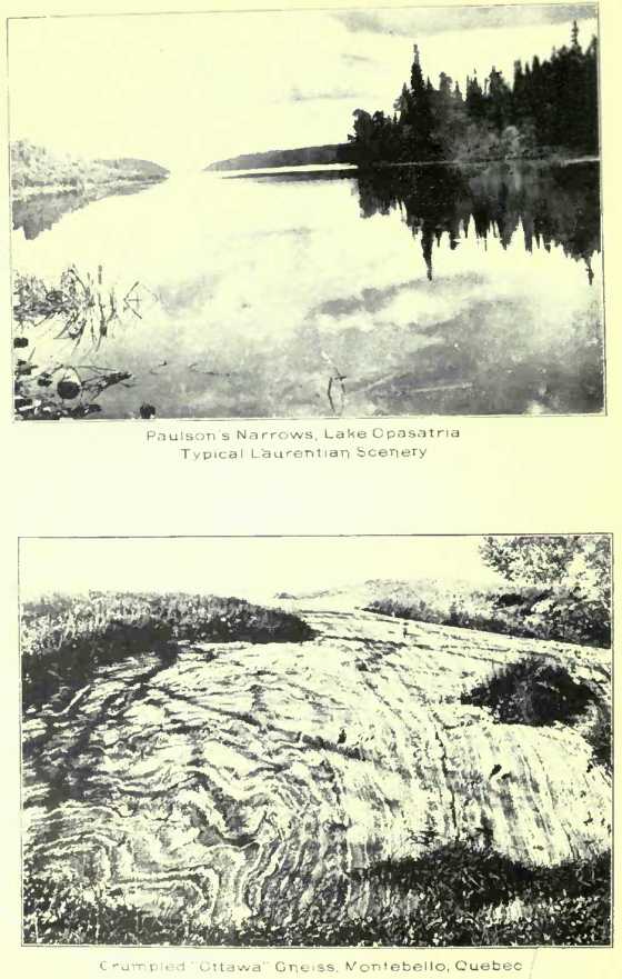
The striking features
of the Laurentian plateau are innumerable lakes, large and small, with
intervening rounded rocky elevations, wooded in their natural conditions
to the south but rising above the tree line to the northward, while in
the far north, on both sides of Hudson Bay, hills and valleys become
eventually characterized by grasses, mosses and lichens alone,
constituting the great “barren lands” of North America. The rivers and
lakes are everywhere well stocked with fish, while deer and moose in the
southern parts, and to the north the caribou, abound. Thus, where the
region can be entered without undue difficulty, it has already become a
much favored resort of the sportsman.
The Laurentian plateau,
also known as the Canadian Shield and as Laurentia, is composed of
several groups of rocks. As at present known, the oldest consists
largely of voloanics, “greenstones,” often schistose, accompanied by
some sedimentary schists, limestones and an “iron formation.” This
group, found in northern and western Ontario, and known as the Keewatin,
rests on intrusive granitic rocks that also occupy large areas over
which they are frequently gneissic. Some basic igneous rocks are also
found intrusive in these older rocks.
This whole assemblage
of prevailingly igneous rocks is characterized by its great
metamorphism. It has been subjected to intense disturbances, regional in
extent. It formed a land area whose surface was eroded into hill and
vale, very much like the present surface of the Laurentian plateau,
before the next succeeding, well recognized system of rocks known as the
Huronian was laid down. This svstem is largely sedimentary, as the
preceding was largely igneous; conglomerates, slates and quartzites are
the characteristic rocks of this system. These relationships are best
seen in the Lake Superior and Temiskaming regions, but over considerable
districts they have been obscured by later intrusions of granitic rocks.
The Huronian as it
occurs in the original locality on the north shore of Lake Huron is
divisible into two portions, known as the Lower and Middle Huronian.
Traced westward into the United States, the Huronian system has been
found to be divisible into three portions, of which the upper, the Upper
Huronian or Animikie, is typically developed in Canada near Port Arthur
on Lake Superior. Younger than the Animikie, a group of sandstones,
conglomerates and trap known as the Ke-weenawan or Nipigon system, is
well developed near Lake Nipigon, north of Lake Superior. The age of
these rocks is generally supposed to be pre-Cambrian, though by some
held to be Lower Cambrian.
In eastern Ontario and
the adjoining portions of Quebec the pre-Cambrian rocks consist of a
distinctly stratified series of limestones and other sedimentary rocks,
usually highly altered and crystalline, with a second series of more
gneissic intrusive rocks, whose apparent bedding is really a foliation
due to pressure and which frequently pass into granites by imperceptible
gradations. The first of these is known as the Grenville series, the
second has been termed the Fundamental or Ottawa Gneiss.
Sir William Logan, who
studied the “Fundamental” (Ottawa) Gneiss, the Grenville series and the
Huronian, recognized the great unconformity between the Huronian and the
older rocks and the metamorphosed character of the latter as contrasted
with the comparatively unaltered, distinctly sedimentary nature of the
former. He therefore divided the pre-Palaeozoic rocks into Huronian,
which he defined as embracing the pre-Cambrian above this unconformity,
and Laurentian, which embraced everything below. .
An international
committee on nomenclature, representing Canadian and American
geologists, has recommended the following classification of the
pre-Cambrian. Opposite is placed a classification based on Logan’s and
in general agreement with the use of the terms in the reports of the
Canadian Geological Survey, though in reconnaisance work the distinction
between Keewatin and Huronian has not always been observed.
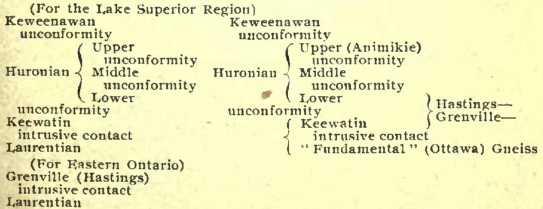
In reference to the
above table, it may be stated that the Laurentian as defined by the
International Committee is restricted to the pre-Huronian granites and
gneisses, and that the relationships between Grenville and Keewatin,
owing to their geographical distribution, is not yet established.
The greater part of the
great Laurentian plateau, following the usage of the Canadian Geological
Survey, may be represented as Laurentian, since it is dominantly
underlain by granite rocks or their gneissic modifications, Keewatin or
the Grenville series as found in their typical localities. But
throughout this vast region are many areas, 'often of considerable
extent, occupied by Huronian and, possibly, Keweenawan rocks. Both east
and west of Hudson Bay rocks similar to the Animikie characterize
considerable districts, and in the far north, west of Hudson Bay, are
areas of rocks probably referable to the Keweenawan.
Though the region of
the Canadian Shield was, during pre-Cambrian time, the scat of repeated
widespread disturbances and invasions of plutonic rocks, amongst which
the extensive bodies of anorthosite distributed along the south-western
border of the region and the varied alkali and nephiline syenites of
Eastern Ontario are especially notable, yet, since earliest Palaeozoic
times the region does not appear to have been affected by regional
disturbances, nor does there appear to have been even local intrusions
of igneous rocks.
The rocks of the
pre-Cambrian are remarkable for the variety of useful and valuable
minerals they contain. Iron, copper, nickel, cobalt, silver, gold,
platinum, lead, zinc, arsenic, pyrite, mica, apatite, graphite,
molybdenite, feldspar, corundum, talc, actinolite, the rare earths,
ornamental stones and gems, building materials, all are found, and most
of them are being or have been profitably mined.
In the tongue of these
rocks, which in ;the Lake Superior region extends into the United
States, are the great iron ranges, which have produced 400 million tons
or ore. and which are expected to furnish 1,500 million tons more; and
here also are the great Lake Superior copper mines that have produced
four and a half billion pounds of copper and are still increasing their
annual production. The fringe of the Laurentian plateau that is explored
in Canada has also been prolific. Near Sudbury are the greatest nickel
mines in the world, and in the Cobalt-Montreal River district what
promises to be one of the greatest silver districts. Iron ore formation,
which occurs in the Keewatin, Lower and Upper Huronian, occurs in
patches throughout the whole extent of Northern Ontario into Quebec.
Iron ores are also found in Eastern Ontario and Quebec. Copper is
important in the nickel deposits, and is also found in separate
deposits. Mica is an important product in Eastern Ontario and Quebec.
Some of the deposits are probably unexcelled anywhere. The corrundum
deposits of Eastern Ontario are unique. Gold has been mined in Eastern
Ontario and in the Lake of the Woods district. Feldspar and pyrite
mining is important. In the far north, explorers report occurrences of
much the same minerals as known along the southern fringe of the
Laurentian plateau.
The Arctic Archipelago.
The islands of the Arctic archipelago extend from the north side of
Hudson Bay and Hudson Strait for a distance of 1,500 miles, while their
greatest extension east and west is along the 73rd parallel, a distance
of 500 miles. The total area of these northern islands is well over
500,000 square miles, of which Baffin Island, the largest, occupies
about 200,000 square miles.
Though naturally much
diversified in their physical aspects, the Arctic Islands are
characterized in the east, in Baffin, North Devon and Ellesmere Islands
by a general tableland rising to elevations of 2,000 to 3,000 feet, but
increasing in the north-eastern part of Baffin Island to 5,000 feet,
with hills rising perhaps one or two thousand feet higher, while in the
northern part of Ellesmere Islands isolated mountain peaks reach nearly
to 5,000 feet. Westward of Ellesmere Island the general elevations of
the islands of the Parry and Sverdrup groups lie below 1,000 feet. The
large islands lying along the border of the continental land, south of
the preceding groups and west of Baffin Island, have general elevations
of usually less than 500 feet, though in the westernmost island, Banks
Island, the general elevation is above 1,000 feet, while the southern
part reached an altitude of 3,000 feet.
The greater part of
Baffin Island is occupied by pre-Cambrian rocks resembling those of the
Labrador peninsula, which extend on northward through North Devon and
Ellesmere Islands. Virtually, the pre-Cambrian rocks of Baffin and the
adjoining islands to the west occupy an area which, with the U-shaped
Laurerltian plateau, entirely encloses Hudson Bay.
Save in the extreme
north, on Ellesmere Island where Cambrian rocks passing up into
Ordovician rest on the pre-Cambrian, there is usually a considerable
time break in the geological sequence between the ancient crystalline
rocks and the earliest Palaeozoic measures, usually of Ordovician age.
Parts of the western portion of Baffin Island and of the islands to the
west, including Victoria Island, are largely occupied by limestones of
Ordovician and Silurian age. Banks Island still further west and the
Parry Group to the north, and the islands north of Lancaster Sound, are
occupied by Devonian and Car boniferous strata, as well as older
formations, while the Sverdrup group is largely of Mesozoic strata.
Isolated patches of lignite-bearing Tertiary beds occur on the coast of
Baffin Island and elsewhere.
Mention may here be
made of the extensive Palaeozoic basin of flat-lying measures bordering
the southern shores of Hudson Bay from the north of the Churchill River
eastward to the foot of James Bay, a distance of about 800 miles. This
relatively narrow basin extends south-westward of James Bay to within
120 miles of Lake Superior: South of James Bay the area is largely
occupied by Devonian beds, with an interrupted fringe of Silurian and
sometimes Ordovician measures. West’ ward of James Bay the strata are
largely Silurian, bordered over considerable areas to the south by
Ordovician. Palaeontological evidence suggests a former connection on
the one hand with the Palaeozoic basin of the Arctic Islands, and on the
other with the ancient inland sea at one time occupying Manitoba. Also,
in the Devonian times at least, it seems probable that a Palaeozoic sea
stretched southward from James Bay to the region of the Great Lakes.
Glaciation of Eastern
Canada. Something may be added here on the events of the glacial period
as affecting the eastern part of Canada as a whole, although many points
connected with this particular period still remain uncertain and the
subject of debate. Like the Scandinavian peninsula, the Laurentian
plateau at one stage in the glacial period apparently became the seat of
a great confluent ice-sheet, which, when at its maximum, flowed down
from it in all directions in general conformity with its main slopes.
Climatic conditions and relatively local physical features may have
conspired to render the discharge of glacial ice more important in some
directions than in others, and it is even possible that at no single
time was the whole extent of the plateau equally ice-clad. To this
continental ice-sheet the name Laurentian glacier has been given, and as
there is reason to believe that at times, probably both at the beginning
and near the close of the glacial period, there were two principal
subordinate centres of distribution, one to the west, the other to the
east of Hudson Bay; to these the names Keewatin and Labradorian glacier
have been given.
During the whole of
this period the Laurentian plateau was in the main an area of
denudation. From it the surface material was carried away in all
directions, even to the northward, for there is absolutely no evidence
that any “polar ice-sheet” ever trenched upon the continent of North
America. The generally bare ice-scored rocky surface of these highlands
is evidence of this denudation, while the existence of broken, angular
masses of unmoved local debris in the central part of Labrador and in
the central area of the Keewatin glacier shows that across these neutral
gathering-grounds no ice ever passed.
As to the distance to
which the solid glacier-ice came southward from the Laurentian plateau,
the evidence with respect to the Labradorian glacier is yet
inconclusive. Neither is it certain at how many times or to what extent
the glacial period was interrupted by relatively warm epochs, but it may
be stated that the flora of at least one of these interglacial epochs,
as represented in the vicinity of Toronto, is such as to indicate a
climate fully as warm as that at present existing, during which it seems
improbable that much, if any, glacier-ice could have persisted on the
Latirentian highlands.
These problems cannot
be discussed here, but it is certain that towards the decline of the
glacial period, the region of the Great Lakes was occupied by a
succession of fresh-water basins, presumably impounded by the northward,
retreating edge of the continental glacier. The evidence of the former
existence of these lakes is furnished by numerous beaches, such as the
Iroquois and Algonquin beach; somewhat analogous, high level beaches
also exist in the valley of the lower St. Lawrence. As a result,
southern Ontario is covered by deposits of till, glacial clays, glacial
lake clays, etc.
After the final
disappearance of the ice-sheet, the
eastern part of Canada,
as a whole, stood at a relatively low level. Without quoting in detail
the heights to which the sea is known to have reached at this time in
various places, it may be stated that it invaded the St. Lawrence valley
as far at least as Lake Ontario. Deposits holding marine shells of
sub-arctic type have been found at Montreal to a height of 560 feet, and
near Ottawa to a height of 470 feet. As a result of the circumstances
noted, the St. Lawrence plain as far west as Ottawa, and nearly to
Kingston on Lake Ontario, is deeply covered by deposits due to the
glacial period, including boulder-clay, Leda clay, and an overlying
Sazicava sand, the two last often full of fossil shells of the period.
In the coastal regions of the maritime provinces similar deposits occur,
to which the same names have been extended, but to the west, around the
Great Lakes, no marine forms have been found.
Before leaving the
subject it may be noted that it is doubtful if the Laurentide glacier in
the east ever crossed the Gaspe peninsula. In New Brunswick and adjacent
parts of the State of Maine, during some part of the glacial period, a
separate, small gathering ground of ice existed, which has been called
the Appalachian glacier. The Magdalen Islands, in the centre of the Gulf
of St. Lawrence, appear never to have been glaciated, and it is at least
a matter of doubt whether any ice, except that originating on the
peninsula itself, ever passed over Nova Scotia.
The Interior
Continental Plain. This is bounded on the west by the Rocky Mountains,
running about north north-west, and on the east by the edge of the
Laurentian plateau, which, taking a, more westerly direction than the
mountains, causes the gradual narrowing of the intervening plain to the
north Thus on the 49th parallel, here constituting the southern boundary
of Canada, the plain has a width of about 800 miles; but it is reduced
to less than 400 miles on the 06th parallel. North of the 62nd parallel
it is greatly narrowed, the surface becomes more irregular, and is
broken by several narrow mountain ranges paralleling the Rocky
Mountains.
The southern part of
the great plain is much the most important from an economic point of
view, and is also that about which most is known. It includes the wide
prairie country of the Canadian west, with a spread of about 193,000
square miles of open grass-land, an area more than twice that of Great
Britain. Beyond the North Saskatchewan River the plain becomes
essentially a region of forest, with only occasional prairie tracts,
such as those of the Peace River valley. By chance, rather than by
intention, the boundary line of the 49th parallel, to the west of the
Red River, nearly coincides with the low watershed which separates the
arid drainage-basin of the Missouri from that of the Saskatchewan and
its tributaries, cutting off only 20,000 square miles from the Missouri
slope. Another line, nearly coinciding with a second low, transverse
watershed, may be drawn on the 54th parallel. The watershed crosses this
line several times, but in the main it may be taken as dividing the
Saskatchewan system of rivers from those of the Mackenzie and the
Churchill. The belt of country comprised between these latitude lines is
350 miles wide, with a total area of about 295,000 square miles.
The whole interior
plain slopes eastward or northeastward, from the Rocky Mountains towards
the foot of the Laurentian highlands, so that a line drawn from the base
of the mountains near the 49th parallel to Lake Winnipeg shows an
average descent of over five feet to the mile, fully accounting for the
generally rapid courses of the rivers of the region. There are, however,
in the area to the south of the 54th parallel two lines of escarpment or
more abrupt slope, which serve to divide this part of the plain into
three portions, and although such a division is by no means definite, it
may usefully be alluded to for purposes of description.
The first or lowest
prairiedevel is that of the Red River valley, of which the northern part
is occupied by the Winnipeg group of lakes, its average elevation being
about 800 feet above the sea, although gradually rising to the
southward, along the axis of the valley, till it reaches a height of 960
feet about 200 miles to the south of the International boundary. Its
area in Canada is about 55,000 square miles, including the lakes, and to
the south of Lake Winnipeg it comprises some 7,000 square miles of
prairie land, which to the eye is absolutely flat, although rising
uniformly to the east and west of the river. This is the former bed of
the glacial “Lake Agassiz,” the sediments of which constitute the
richest wheat lands of Manitoba.
The escarpment bounding
the plain on the west begins at the south in what is known as “Pembina
Mountain," and is continued northward in the Riding, Duck, Porcupine and
Pasquia Hills, which overlook Manitoba and Winnipegosis Lakes,
constituting the main eastern outcrop of the Cretaceous rocks of the
plains. From this escarpment the second prairie-level extends westward
to a second and nearly parallel marked rise, which, in general, is known
as the Missouri Coteau. The area of this plain is about 105,000 square
miles, of which more than half is open prairie. Its average elevation is
about 1,600 feet, and its surface is more diversified by undulations and
low hills and ridges than that of the last, while the river-valleys are
often deeply cut as well as wide. The greater part of the surface is
well adapted for agriculture, although in places the scarcity of trees
constitutes a disadvantage. The character of the soil is also more
varied than that of the lower plain.
The third and highest
plain, lying between the last and the base of the Rocky Mountains, may
be stated to have an average height of 3,000 feet, with an area, between
the parallels of latitude referred to, of about 134,000 square miles, of
which by far the greater part is absolutely devoid of forest, its wooded
area being confined to its northern and north-western edges, near the
North Saskatchewan River or its tributaries. The surface of this plain
is still more irregular than that of the last, and it is evident that
both before and after the glacial period the denuding forces of rain and
rivers have acted upon it longer and more energetically. Table-lands
like those of the Cypress Hills and Wood Mountain must be regarded as
outlying remnants of an older plain of the Tertiary period, and the
slopes and flanks of such outliers show that similar processes of waste
are still in operation, adding to the length and depth of the ravines
and “coulees,” by which the soft Cretaceous and Tertiary rocks are
trenched. The deposits of the glacial period, with which even this high
plain is thickly covered, have tended to modify the minor asperities
resulting from previous denudation. The soil is generally good, and
often excellent, but large tracts to the south and west are sub-arid in
character; these, while suited naturally rather for pasturage than for
ordinary agriculture, are easily rendered fertile by irrigation, and are
also responding to the methods of “dry farming.” Along the base of the
Rocky Mountains is a belt of “foot-hills,” forming a peculiar and
picturesque region, of which the parallel ridges are due to the
differing hardness of the Cretaceous rocks, here thrown into wave-like
folds, as though crushed against the resistant mass of the older strata
of the mountains Taken as a whole, the central plain of the continent in
Canada may be regarded as a great shallow trough, of which, owing
doubtless to post-Tertiary differential uplift, the western part of the
floor is now higher in actual elevation than its eastern Laurentian rim.
But although thus remarkably simple and definite m its ,?rand plan,
there are many irregularities in detail. The second prairie-level has,
for instance, some elevations on its surface as high as the edge of the
third plain, both to the west and east of the valley of the Assiniboine
River, -which, again, is abnormally depressed. It is not possible here
to do more than characterize its features in a general way.
Ever since an early
Palaeozoic time, the area now occupied by the interior plain appears to
have remained undisturbed, and to have been affected only by wide
movements of subsidence or elevation, which, although doubtless unequal
as between its different parts, have not materially affected the
regularity of the strata laid down. Upon this portion of the continental
platform, in its eastern parts on Lake Winnipeg and its associated
lakes, Ordovician, Silurian and Devonian rocks are found outcropping
along the stable base of the Laurentian plateau. Following this line of
outcrop northward, the Devonian rocks gradually overlap those of older
date and rest directly upon the pre-Cambrian. They continue to the
Arctic Ocean and there occupy a great part of the Northern Archipelago.
To the south of Athabasca Lake they rest, without any apparent angular
unconformity, upon sandstones referred to very late pre-Cambrian or
possibly Lower Cambrian, giving evidences in the stratigraphical hiatus
of prolonged periods during Palaeozoic time in which land as well as
water existed in some parts of the area. On the western side of the
Great Plains the Palaeozoic strata reappear crumpled and broken in the
Rocky Mountains, where the vast crustal movements of the Cordilleran
belt found their inland limit.
These rocks consist for
the most part, of pale-grey or buff, often magnesian, limestones along
the eastern outcrop, and from them has been described an extensive and
somewhat peculiar fauna. Some, at least, of the Palaeozoic formations
represented probably extend beneath the entire area of the Great Plains,
but they are wholly concealed there by later strata of Cretaceous age,
consisting chiefly of clay-shales and sandstones, generally but little
indurated and flat-lying, or nearly so. The uniformity of the surface
features of this country is principally due to that of these deposits,
which, although since greatly denuded, have worn down very equally and
have apparently never been very long subjected to, waste at a great
height above the base-level of erosion. The whole area has in fact been
one rather of deposition than of denudation up to a time geologically
recent, and has very lately been levelled up still further by 'the
superficial deposits due to the glacial period.
The Cretaceous rocks
are for the most part distinctly marine, although, beginning with the
Dakota sandstones in the south, the tar-cemented sands on the Athabasca
and elsewhere in the north-west, and the parallel beds, often of coarse
material and in greatly increased volume, of the upturned measures of
the Rockies, perhaps indicate river-born detritus won from the elevated
western country.
In the eastern part of
the plains, the Dakota sandstones are succeeded by the Benton shales,
the Niobrara, largely calcareous and foraminiferal in some places, the
Pierre shales and, lastly, the Fox Hill sandstones. These beds were
probably all deposited in a shallow sea. spreading over the territory
underlain by the Dakota measures. But further west in Alberta, during
the interval represented by part of the Pierre and possibly the
Niobrara, the country, over a wide extent, for a time was in a
fluctuating state, so that brackish water and fresh water deposits, the
Belly River formation, with beds of lignite, formed, but finally were
again succeeded by marine deposits. The Dunvegan series of the Peace
River, to the north, similarly characterized, is perhaps somewhat older.
The Cretaceous strata in fact change very materially in composition and
character toward the Rocky Mountains, and when followed to the north
give rise to the necessity for local names and render a precise
correlation difficult in the absence of connecting sections over great
tracts of level country.
All the Cretaceous
strata so far referred to belong to the later stages of that system, but
in the foot-hills the earlier Cretaceous is represented by the Kootanie
formation, holding coal, and reappearing as in folds in the eastern
ranges of the Rocky Mountains. One of these is followed by the valley of
the Bow River between Banff and Canmore, and affords both anthracite and
bituminous coal.
Overlying the
Cretaceous rocks proper, in considerable parts of their extent,
particularly in Alberta, are those of the Laramie, which, although
perfectly conformable with the marine strata beneath, contain brackish
water, and in their upper part entirely fresh water forms of molluscs,
together with an extensive flora and numerous beds of lignite-coal or
coal. As a whole, this formation may be regarded as a transition from
the Cretaceous to the Tertiary, with a blending of organic forms,
elsewhere considered as characteristic of one or the other. The lower
parts are undoubtedly most nearly related to the Cretaceous, and
particularly to the Belly River beds, which were laid down under similar
physical conditions at an earlier stage. The remains of Dinosaurian
reptiles are still abundant in these. The upper beds, constituting what
was originally named the Fort Union group, with its local
representatives under different names, is, on the contrary, more nearly
allied to the Eocene.
A still later stage in
the Tertiary is represented by ' beds of Oligocene, found particularly
as an outlier capping the Cypress Hills. These have afforded numerous
mammalian bones, referred to the stage of White River beds' of the
Western States.
The aggregate thickness
of the Cretaceous strata of the plains, so far as known, may in the
eastern part be stated as about 2,000 feet; in the west, in northern
Alberta, it is about the same, but exceeds 2,500 feet in south-western
Alberta, without including the Kootanie series of some 7,000 feet or
more. The thickness of the Laramie is also great towards the Rocky
Mountains, reaching probably §§700 feet. The Pliocene (with perhaps the
latter part of the Miocene) appears to have been a time of erosion only,
in the area of the Canadian plains; wide, flat-bottomed valleys were cut
out in the foothills, and to the cast of these great tracts of country
between the now outstanding plateaux must have been reduced to the
extent of 1,000 feet or more in height.
The Interior plateau is
pre-eminently an agricultural country; minerals are practically confined
to the non-metallic substances. These, however, will give rise to
important industries. The most important are the mineral fuels in the
form of coals, lignite coals and natural gas, with which the plateau is
richly supplied. These are obtained from the Cretaceous and Laramie
rocks. , The coal-bearing region of the north-west, between the
International Boundary line and the 56th degree of latitude is
approximately 65,000 square miles in extent. The Souris River country
and the region about Medicine Ilat yield lignite only. In western
Alberta excellent lignite coals occur, which are being worked at a
number of points. In the foot-hills adjacent to the mountains are many
deposits of bituminous coal. Natural gas has been found in great
quantity, particularly in the region about Medicine Hat, and also two
hundred miles north of Edmonton. There is good evidence of the gas
fields having a wide extent throughout this region. Great outcrops of
Cretaceous sandstones saturated with tar or maltha occur along the
Athabasca River, probably evincing the existence of important petroleum
reservoirs. Salt springs occur on the borders of Manitoba Lake and in
the Athabasca basin. Gypsum also occurs along the eastern outcrop of the
Silurian and Devonian rocks, and on the Peace River. Building stones are
found, and clay suitable for brick and certain kinds of pottery. The
Devonian limestones will probably prove important for cement-making in
the East and North, as the Devona Carboniferous of the Rockies have
already begun to be.
The Cordillera. Of this
great mountainous region of the Pacific Coast, a length of nearly 1,300
miles, is included by the western part of Canada. Much of this is
embraced in the Province of British Columbia, where it has a width of
about 400 miles between the Great Plains and the Pacific Ocean. To the
north it is continued in the Yukon district to the shores of the Arctic
Ocean on one side, and on the other passes across the 141st meridian of
west longitude into Alaska. Its strongly marked features result from
enormous crustal movements parallel to the edge of the Pacific, by which
its strata have at several periods, and along different lines, been
crumpled, crushed and faulted. These movements having continued at
intervals to times geologically recent, the mountains produced by them
still stand high and rugged, with streams flowing rapidly and with great
erosive power down steep gradients to the sea.
Although preserving in
the main a general northwesterly trend, the orographic features of this
region are very complicated in detail. No existing map yet properly
represents even the principal physical outlines, and the impression
gained by the traveller or explorer may well be one of confusion.
Disregarding, however, all minor irregularities, two dominant mountain
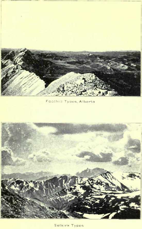
systems are discovered—the Rocky Mountains proper on the east, and the
Coast Range of British Columbia on the west.
The first of these it
has been proposed to name, from an orographic point of view, the
“Laramide Range,” as it is essentially due to earth movements, occuring
about the close of the Laramie period, and rocks of that age are
included in its flexures. Although not quite continuous (for there are
two echelon-like breaks), this range, beginning two or three degrees of
latitude to the south of the 49th parallel, forms the eastern member of
the Cordillera all the way to the Arctic Ocean, which it reaches not far
to the west of the Mackenzie delta. It is chiefly composed of Palaeozoic
rocks, largely limestones, and where it has been closely studied, is
found to be affected by series of overthrust faults, parallel to its
direction, of which the easternmost separates it from the area of the
Cretaceous foot-hills. Here the older rocks have been thrust eastward
for several miles over the much newer strata. The structure has as yet
been worked out in detail only along the line of the Bow River Pass. In
width this range seldom exceeds sixty miles. The heights formerly
attributed to some peaks appear to have been exaggerated, but any points
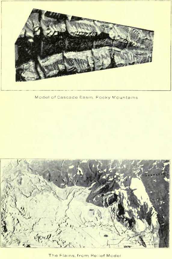
in its southern part exceed 11,000 or 12,000 feet.
The Coast Range of
British Columbia constitutes the main western border of the Cordillera.
Beginning near the estuary of the Fraser River, it runs uninterruptedly
northward, with an average width of about 100 miles, for at least 900
miles, when it passes inland beyond the head of Lynn Canal. This range
is largely composed of granite and more basic plutonic rocks, with
infolded masses of altered Palaeozoic and possibly later strata. It is
not, as a rule, so rugged in outline as the last, but its western side,
rising from the sea, shows the full value of its elevation there, while
its main summits often exceed 8,000 or 9,000 feet. Several rivers rising
in the plateau country to the eastward flow completely across this range
to the Pacific, where the lower parts of their valleys, as well as those
of many streams originating in the mountains themselves, in a submerged
state constitute the remarkable system of fiords of British Columbia.
Even in the arrangement of the islands adjacent to the
coast, the further
extension of these valleys, and of others running with the range, may be
traced, the evidence being of great subaerial erosion, when the land
previously stood at a higher stage. The cutting out of these deep
valleys probably began in Eocene times, but was renewed and greatly
increased in the later Pliocene.
Outside the Coast
Range, and in a partly submerged condition, lies another range, of which
Vancouver Island and the Queen Charlotte Islands are projecting ridges.
This stands on the edge of the Continental plateau, with the great
depths of the Pacific beyond it. The ro£ks resemble those of the Coast
Range, but include also masses of Triassic and Cretaceous strata which
have participated in its folding, while horizontal Miocene and Pliocene
beds skirt some parts of the shores.
In the inland portion
of British Columbia, between the Coast and Rocky Mountain systems above
particularly alluded to, are numerous less important mountain ranges
which, while preserving a general parallelism m trend, are much less
continuous. Thus, in travelling westward by the line of the Canadian
Pacific Railway, after descending from the Rocky Mountain summit and
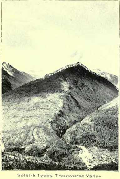
crossing the Upper Columbia valley, the Selkirk Range has to be
surmounted. Beyond this, the Columbia on its southern return is again
crossed, and the Gold Range is traversed by the Eagle Pass before
entering the Interior Plateau of British Columbia, which occupies the
space remaining between this and the Coast Range. The system of ranges
lying immediately to the west of the Rocky Mountains proper,
notwithstanding its breaks and irregularities, is capable of approximate
definition, and its components have been designated collectively the
Gold Ranges. Further north it is represented by the Cariboo Mountains,
in the mining district of the same name. The highest known summit of
this system is Mount Sir Donald, 10,645 feet, one of the Selkirk
Mountains. This mountain system is believed to be the oldest in British
Columbia It comprises pre-Cambrian rocks with granites, and <a great
thickness of older Palaeozoic beds, much disturbed and altered.
The Interior Plateau
region constitutes an important physical feature. Near the International
Boundary it is terminated southward by a coalescence of rather irregular
mountains, and again, to the northward, it ends about latitude 55° 30’
in another plexus of mountains without wide intervals. Its breadth
between the margins of the Gold Ranges and the Coast Range is about 100
miles, and its length is about 500 miles. It is convenient to speak of
the country thus defined as a plateau because of its difference, in the
large, from the more lofty bordering mountains. Its early Tertiary
topography has been greatly modified by volcanic accumulations of the
Miocene, and by rivcr-erosion, while it stood at a considerable
altitude, in the Pliocene ; but its plateau-like character is not
obvious until some height has been gained above the lower valleys, where
the eye can range along its level horizon-lines. It is highest to the
southward, but most of the great valleys traversing it are less in
elevation than 3,000 feet above the sea. To the north, and particularly
in the vicinity of the group of large lakes occuring there, its main
area is less elevated than 3,000 feet, making its average height about
3,500 feet.
Beyond this plateau to
the north, the whole widlh of the Cordillera, very imperfectly explored
as yet, appears to be mountainous as far as the 59th parallel of
latitude, when the ranges diverge or decline, and in the upper' basin of
the Yukon, roiling or nearly flat land, at moderate elevations, again
begins to occupy wide intervening tracts.
As a whole, the area of
the Cordille in Canada may be describe.1 as forest-clad, but the growth
of trees is more luxuriant on the western slopes of each of the Cinmmanl
mountain ranges, in correspondence with the greater precipitation
occuring on these slopes. This is particularly the case in the coast
region and on the seaward side of the Coast Range, where magnificent and
dense forests of coniferous trees occupy almost the whole available
surface. The Interior Plateau, however, constitutes the southern part of
a notably dry belt, and includes wide stretches of open, grass-covered
hills and valleys, forming excellent cattle ranges. Further north. .
along the same belt, similar open country appears intermittently, but
the forest invades the greater part of the region. It is only toward the
Arctic coast, in relatively very high latitudes, that the barren Arctic
tundra country begins, which, sweeping in wider development to the
westward, occupies most of the interior of Alaska.
With certain exceptions
the farming land of British Columbia is confined to the valleys and
tracts below gM\3,000 feet, by reason of the summer frosts occuring at
greater heights. There is, however, a considerable area of such land in
the aggregate, with a soil generally of great fertility. In some of the
southern valleys of the interior, irrigation is necessary for the growth
of crops. Fruit growing is becoming one of the important industries.
The geological
structure of the Cordillera is extremely complicated, and it has as yet
been studied in detail over limited tracts only. There have been no
appropriate terms of comparison for the formation met with, and these it
has consequently been necessary to investigate independently by the
light of first principle. The difficulty is increased by the abundance
of rocks of volcanic origin referable to several distinct periods,
resembling those of the Appalachian mountain region, though on a vastly
greater scale, and, like them, almost entirely devoid of organic
remains. The recognition, early in their investigation, has rendered it
possible, however, to understand the main geological features, which at
first appeared to present an almost insoluble problem.
The oldest rocks
recognized consist of crystalline schists probably of pre-Cambrian age,
though possibly intricately associated with highly-altered Palaeozoic
strata and metamorphosed igneous material. In the Gold Range and
Interior Plateau region they have been distinguished as the Shuswap
series. They include rocks lithologically resembling the Laurentian
gneisses of the east, together with crystalline limestones, quartzites
and gneisses like those of the Grenville series. In the Yukon, where
similar rocks arc widely developed, they have been grouped under the
name of the Nasina series, held to be at least pre-Ordovician in age.
In the Rocky Mountains,
Gold Ranges, and elsewhere is a great thickness of Palaeozoic rocks
which, in the Rocky Mountain Range, towards the south, is underlain by a
considerable volume of relatively unaltered, pre-Cambrian sediments.
Cambrian fossils have been recovered from the lower Palaeozoic beds in
the south, where the whole of the Cambrian is represented by highly
fossiliferous measures, and again in the far north. West of the Rocky
Mountains the Cambrian and, in general, the succeeding Palaeozoic
systems, are largely represented by volcanic material. The Ordovician
and Silurian, on the evidence in each case of a few characteristic
fossils, are known to exist at several points in the Rocky Mountains
proper. The Devonian has not been distinctly recognized.
In the Rocky Mountains,
the Carboniferous is largely represented, chiefly by massive limestones,
and the fossils found in these pass down to a stage which has been
characterized as Devono-Carboniferous. No single trace of the flora of
the Carboniferous period has yet been discovered in the western regions
of Canada. In the Interior Plateau and along the Coast, the
Carboniferous insists below of volcanic accumulations and quartzites and
above of limestones, some of which are largely foraminiferal.
The Triassic, in the
southern part of the Rocky Mountains proper, is represented by red
sandstones, the deposits of an interior Mediterranean of the period. To
the west and north it becomes a marine formation, with peculiar fossils
of the “Alpine Trias” type, but over large areas it consists almost
entirely of contemporaneous volcanic accumulations.
The Jurassic occurs in
the Queen Charlotte Islands and the Fernie shale, underlying the
Kootanie formation in the southern portion of the Rocky Mountains,
probably belongs to the same system. Rocks of earlier Cretaceous occur
in places in the Rocky Mountains and throughout British Columbia as far
as the coast, also northward to the Porcupine River, between latitudes
67° and 68°, in the Yukon District. Newer Cretaceous rocks are developed
particularly in Vancouver Island, where they constitute the productive
coal measures. In the Crow’s Nest Pass region and elsewhere in the Rocky
Mountains, as well as in the Queen Charlotte Islands, the earlier
Cretaceous rocks contain abundance of good coal. All the. strata of the
Cretaceous period are more or less filted and folded, and are evidently
prior in date to the last great organic movements of the Cordillera.
Evidences of contemporaneous volcanic action are again abundant in some
parts of the extent of the Cretaceous.
Rocks referable to the
Laramie or transition period between the Cretaceous and Tertiary, are
found in the Yukon District and in the vicinity of the Fraser delta,
holding ligrite coals and numerous remains of plants. Beds assigned to
the Oligocene and Miocene are also well developed in the southern part
of the Interior Plateau of British Columbia, where the latter period has
been an epoch of notable volcanic eruptions, producing both effusive and
fragmental rocks, but toward the close flooding large tracts wi+h
basaltic flows. Traces of similar volcanic activity, of the same date,
are found in the Queen Charlotte Islands and in Vancouver Island. The
Pliocene was chiefly a time of erosion, but deposits referred to this
period are not entirely wanting.
Until the completion of
the Canadian Pacific transcontinental railway, the west coast of Canada
was a remote region, accessible with difficulty; but long before this
coal has been successfully mined in Vancouver Island, and in 1858 and
succeeding years the discovery and working of placer gold deposits
brought the then isolated colony of British Columbia into considerable
prominence. From the time of the quarrel with Spain on the Nootka
question, in 1870, little had been heard of the region, which remained
unprized and suffered naturally in consequence when the “Oregon”
boundary was settled with the United States.
Lode mining may be said
to have commenced about fifteen years ago. In 1893 the annual production
of minerals in British Columbia had a value of about three and a half
million dollars. It now runs in the neighborhood of twenty-five
millions. The lead of Canada is obtained from the silver-lead mines of
East and "West Kootenay. Gold-copper ores are mined extensively at
Rossland, and in the Boundary Creek district are enormous copper-gold
deposits of the contact meta-morphic type, which are worked on a
gigantic scale. Copper is also found in many other parts of British
Columbia, particularly along the Pacific Coast. Lode gold is mined in
West Kootenay and the Similkameen.
The Cordilleran belt in
Canada is not only rich in gold, silver, copper and lead, but it has
enormous resources of coal of excellent quality, ranging from lignites
to anthracite, conveniently situated. It is mined extensively in the
Crow’s Nest Pass, on Bow River, at Nicola, and on Vancouver Island. The
great unprospected areas are known to contain the coal formation, and
will no doubt when explored add greatly to the coal resources.
While well opened up
along the southern fringe of the province, and to some extent along the
coast, and while the main streams have been prospected for placer gold,
the great part of the Cordilleran belt in Canada may be said to be as
yet untouched and its potential wealth in minerals unknown, though it is
certain to become one of the great mining countries.
Glaciation of Western
Canada. Like the eastern part of Canada, the western has been largely
affected by the events of the glacial period. Most of the superficial
deposits can be explained only by reference to this period, and to it
also the diversion of many rivers and streams and other important
changes are due. It is not yet possible to give a connected account of
these events, which will meet with general agreement, but, as in the
east, the main facts have already been made sufficiently plain.
At an early time in the
glacial period, the Cordillera, standing probably at a relatively high
elevation, became covered by a confluent ice-sheet, extending
approximately from latitude 48° to latitude 63°, with a total length at
its maximum of some 1,200 miles. The form of the surface prevented the
ice from discharging in al) directions like that of Greenland, and
forced the bulk of the outflow to move south-eastward and
north-westward, m conformity with the direction of the ruling mountain
ranges, from a central neutral gathering-ground or neve, situated
approximately between the 55th and 59th parallels. The southward-moving
portion of the great glacier filled the Interior Plateau of British
Columbia, whilst its opposite extremity in the mam flowed into the Yukon
basin Smaller streams from the main mass undoubtedly crossed the Coast
Range by transverse valleys, to reinforce secondary, but large glaciers,
which reached the sea to the south and north of Vancouver Island, while
others extended through the Bow River valley and similar depressions to
the western margin of the Great Plains.
This Cordilleran
glacier, as shown by late observations in the western part of the Great
Plains, was the first to affect the region, and may perhaps prove to be
the first notable ice-cap developed during the glacial period in North
America. At a later time it became gradually very much reduced, but
subsequently, at least once again extended to dimensions in some places
approaching those first held by it. Rock striation and the transport of
erratics, show that the southern part of the Cordilleran glacier, when
at its maximum, passed uninterruptedly over projecting points between
6,000 and 7,000 feet in height above the sea.
In the area of the
Great Plains, as above noted, the first recognized evidences of glacial
conditions are those connected with the eastward spread of comparatively
limited tongues of glacier-ice from the Rocky Mountains, and the
deposit, on the western plains, of boulder-clay and rolled gravels
attributed to what it has been proposed to name the Albertan stage.
Subsequently at least two more distinct boulder-clays, separated by
important interglacial deposits, have been laid down over the whole
western part of the Great Plains, ending above in silty, sandy and
gravelly beds, with large scattered superficial erratics. In connection
doubtless with one of these boulder-clays is the remarkable monument of
the glacial period known as the Missouri Coteau (crossed by the Canadian
Pacific Railway, west of Parkbeg station). These later boulder-clays
differ from those of the Albertan stage in being largely composed of
debris of the Laurentian and Huronian rocks and Palaeozoic limestones
found in places on the eastern side of the interior continental plain.
The direction of transport of these erratics has been from the
north-east or north north-east. |