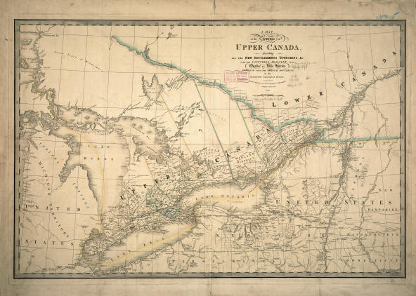
|
Describing all the
new settlements, townships, & cc. with the countries adjacent, from
Quebec to Lake Huron : compiled from the original documents in the
Surveyor General's office Creator: Wyld, James, 1812-1887 Date: 1836
After the American
Revolution, many British Loyalists left their homes in the thirteen
colonies and moved to Canada, settling in the region north of Lakes
Erie and Ontario and south of the Ottawa River. By 1791, the
province of Quebec was divided into Upper and Lower Canada as
depicted on this 1836 map. Lower Canada remained an area of French
culture and settlement, but Upper Canada became a center for British
settlement as reflected in the transplanting of place names from
England especially for counties or districts -- London, Globe,
Midland, Norfolk, New Castle, Northumberland, and York. In addition,
the subdivision of counties into townships with rectangular shapes
followed an American pattern instituted in western New York State in
the 1790s, also shown on this map. With the establishment of the
Dominion of Canada in 1867, Upper Canada became Ontario and Lower
Canada was again known as Quebec.
 |


