|
The Dominion of Canada occupies the northern
portion of the continent of North America—exclusive of Alaska: all
the Arctic islands between Greenland and the 141st meridian being
included within its boundaries. Its area is about 3,729,665 square
mile-.1 The island of
Newfoundland—including some of the lesser islands on the east coast
of the continent—and a narrow strip of land along the adjacent
Labrador coast, forms a separate colony, under the British Grown.
Inclusive of Newfoundland, British North America has an area of
about 3,772,000 square miles. Canada extends from east to west about
3500 miles, and from north to south about 1400 miles. The most
southern point is in Essex countv, Province of Ontario, near
latitude 42° 16' N.
This large area necessarily presents great
diversity of topographic features, and strata of nearly all
geological horizons are represented. On the basis of certain
structural features, it is possible to recognize six great
physiographic units. The greatest single structural unit covers an
area of over 2,000.000 square miles. This unit extends, in a more or
less U shape, from Labrador on the east to Coronation gulf on the
west, bordering the great Hudson Bay depression. It is underlain by
a mass of ancient crystalline rocks, very diverse, and highly
metamorphosed—the roots of the most ancient mountain range on the
continent. These mountains were probably the first land areas of the
North American continent. The originally overlying portions were
gradually removed by various erosive processes, until now,
throughout this vast area, mountain forms are no longer seen; but
their basal structures still remain. So great has been erosion, that
the region is now characterized almost everywhere by the existence
of remarkably even skylines. Here and there, low domed residuals
rise a few feet above the general level, making notable breaks in
the otherwise nearly even surface.
•In detail the topography of this area is
characterized by innumerably small domes and basins, with a relief
of only a few hundred feet or less. Scattered over its surface are
numberless small and large lakes, with numerous streams, which
exhibit many rapids and falls. Nowhere else in the world are small
lakes and connecting streams so plentiful and so widely distributed.
The greater portion of the southern part of the region is covered
with dense forests of spruce. The higher portions of the area in
Labrador, and the extreme northern portions of both the eastern and
western limbs, are nearly destitute of trees; although some few
occur in protected basins. The remarkably even skyline, and certain
other features which characterize the region as a whole, have caused
it to be designated the
Laurentian Peneplain. It is, however, a
very ancient peneplain, which has been elevated and partially
dissected and denuded, producing the present hummocky topography.
The elevation of the plane, as shown by the skylines, varies from
about 500 feet above the sea-level to about 1.100 feet, a very
considerable portion lying below the 1000 ft. contour. The area is
sometimes known as the
Laurentian Plateau.
This area is underlain by ancient crystalline
rocks, ranging from the Laurentian to the Kewecnawan formations. It
is a region of great potential importance as a producer of minerals
of economic value. The mica and phosphate deposits of the Ottawa
valley; the silver mines of Cobalt; the gold deposits of Porcupine;
the nickel-copper deposits of Sudbury; and the iron mines of the
Michipicoten district, all occur within this region. Its
importance—already demonstrated as a source of such minerals as
graphite, feldspar, mica, corundum, iron ores, both magnetites and
hematites, silver, cobalt, copper, nickel, and gold—will,
undoubtedly, be greatly extended in the future.
The
Hudson Bay basin occupies a central
depression in the Laurentian peneplain. The bay itself is a great
inland sea, some 000 miles from east to west, and nearly 1000 miles
from north to south. Bordering the southern and southwestern portion
of this basin, is an area underlain by Palaeozoic rocks, sloping
gently bayward, which may be designated the
Hudson Bay Coastal Plain. At present this
region is largely unexplored, but is known to contain deposits of
rock salt and gypsum.
Southeast of the Laurentian plateau, including a
portion of the province of Quebec (south of the St. Lawrence river
and east of Sherbrooke) and the whole of the Maritime Provinces, we
find the northern extremity of the belt of Appalachian mountain
folds, which extends along the Atlantic coast of the continent. This
area was termed the
Acadian region by Dawson. It is underlain
chiefly by Palaeozoic rocks, which have been subjected to
considerable folding, and, afterwards, were degraded. On the extreme
east, on the Xova Scotia coast, a number of basins contain residuals
of the carboniferous system, in which very important coal fields
occur. A larger but shallower basin of carboniferous rocks also
occurs in Xew Brunswick. The other mineral products of this area are
copper, gold, sulphur, gypsum, oil, gas, sandstones, limestones,
clays, and building and ornamental stones of various kinds.
The next important physiographic unit is the
ancient belted coastal plain which now forms the St. Lawrence
drainage basin (the
St. Lawrence basin).
It extends from the city of Quebec to Lake Huron, and includes the
St. Lawrence lowland in the vicinity of Montreal, and the lowland
areas in the province of Ontario, adjacent to the great lakes. This
region is underlain by Palaeozoic sediments-, limestones,
sandstones, and shales. Its mineral products are salt, gypsum,
natural gas, petroleum, building stones, brick clays, and the raw
materials of various cements, limes, and mortars. This section is
one of the most populous areas in Canada, and. although essentially
an agricultural area, a very considerable percentage of the people
are connected with the industries which arise through the occurrence
of these natural products.
Westward of the Laurentian plateau, from the
city of Winnipeg and Lake Winnipeg, we have the
Great Plains area, or the
Interior Continental Plateau, extending
to the foothills of the Rocky mountains, a distance of about 000
miles. Northward from the United States boundary, at parallel 49°
X.. to the Arctic ocean, is a distance of about 1000 miles. This
area includes two great river basins: the Saskatchewan basin on the
south, and the Mackenzie basin on the north, the divide between them
lying not far from 50° N. latitude. The entire area is underlaid by
sedimentary strata, ranging in age from early Palaeozoic to later
Mesozoic. The southern part of the area, including the greater
portion of the Saskatchewan basin, forms the great
wheat raising districts of Canada. While it is
by no means all occupied, the country is dotted with small towns and
settlements, and is traversed by numerous railways and their branch
lines, including three transcontinental systems. The northern part
of the area, including nearly the whole of the Mackenzie basin, is
only partially explored, and contains very few inhabitants.
The southern parts produce natural gas, building
stones, and the raw materials for cements and mortars. The northern
part is known to contain deposits of rock salt, gypsum, coal, and
tar sands, and it will also produce natural gas, and, probably,
petroleum. The stream beds along the western edge of the area
contain immense gravel deposits washed down from the mountains, some
of which are known to be auriferous. The most important mineral
product of the area, however, is lignite coal, which occurs very
widely distributed over the western portion of the area, and
especially in the southern parts; many of the seams are quite thick,
and the deposits form an exceedingly important source of fuel for
the western provinces of Canada.
The mountain belt of British Columbia and the
Yukon constitute the next great physiographic unit. This is the
northern portion of the great Cordilleran belt, which extends along
the whole western side of the North American continent, from Central
America to Alaska. The Canadian portion of the belt is about 1300
miles in length. On the eastern flank of this Cordilleran belt, we
have the
Rocky Mountain ranges, composed chiefly
of Palaeozoic and Mesozoic rocks. This mountain belt is particularly
important, because of the immense reserves of bituminous coal of
Cretaceous age, found in many sections of the ranges.
Westward of the Rocky mountains, lie a series of
mountain ranges, collectively designated as the
Gold ranges. They are composed of Archean
rocks, with which are associated granites and a great thickness of
older Palaeozoic beds, all much disturbed and metamorphosed.
Westward of these ranges lies a section of country with somewhat
diversified topography, which is usually described as the
Interior plateau of British Columbia. Its
width from east to west is about 100 miles; its extent from north to
south probably about 500 miles. It differs from the mountain ranges
to the east chiefly in the lack of any lofty mountain peaks; its
main elevation is about 3500 feet above sea-level. The plateau has
been the seat of much volcanic action during Miocene times.
Beyond the plateau to the north the whole width
of the Cordillera appears to be mountainous, about as far as the
59th parallel of latitude. Still farther north the ranges decline or
diverge, and in the basin of the upper Yukon rolling or nearly flat
land, at moderate elevations, again begins to occupy wide
intervening tracts.
The western border of the Gordillera, along the
Pacific coast, is formed by the
Coast range. This range runs northward
from near the estuary of the Fraser river to beyond the head of Lynn
canal. It has a breadth of about 100 miles. It consists largely of
granite batholiths. on the margins of which occur highly altered
Palaeozoic sediments.
Beyond the coast range, near the edge of the
continental plateau, a partly submerged range of mountain- forms
Vancouver island and the Queen Charlotte islands. The rocks resemble
those of the Coast range; but include also masses of Triassic and
Cretaceous strata, which have participated in the folding. Lat'-r
Miocene and Pliocene beds occur along some parts of the shores.
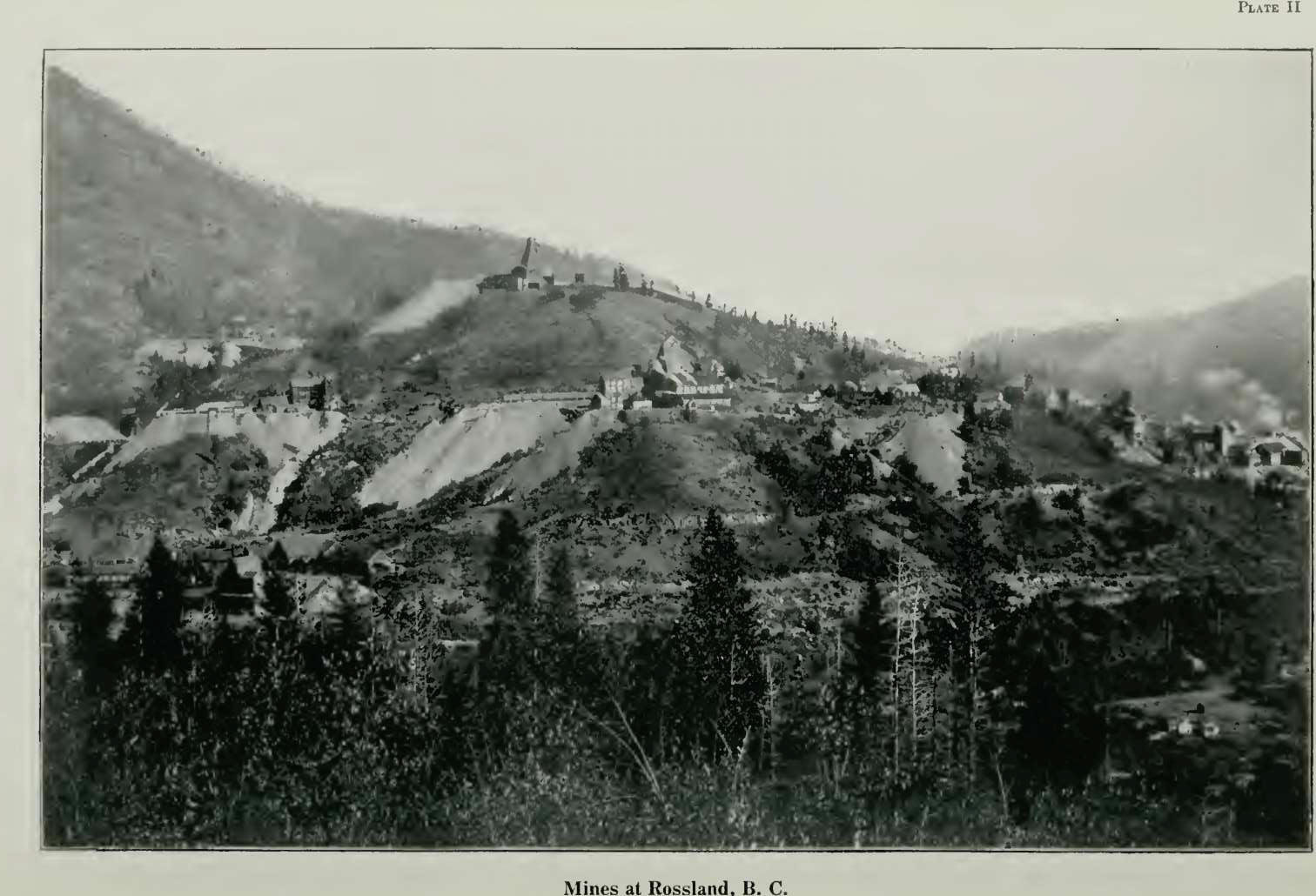
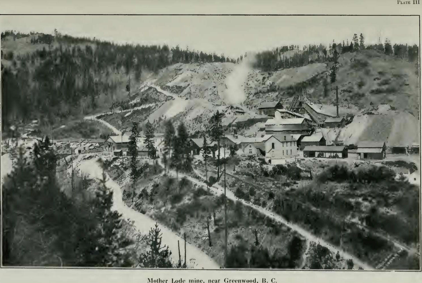
The Cordilleran belt of America is noted for its
important deposits of economic minerals, especially silver, gold,
and copper. In western Canada, it contains important copper,
copper-gold, and silver deposits; and large returns have also been
obtained from gold bearing gravels. Reference has already been made
to the Cretaceous coal deposits of the eastern part of the belt.
Similar deposits of Cretaceous age occur on Vancouver island, and
have been for many years the most important source of fuel on the
Pacific coast.
The Cordilleran region of Canada, when fully
explored, is, undoubtedly, destined to become one of the most
important mining sections of the world.
The following tabulated statement shows the
mineral production in Canada according to the published records of
the Division of Mineral Resources and Statistics of the Mines
Branch. The plantities of metals shown include not only the product
of refineries, etc., which is comparatively small, but also the
metals contained in smelter products produced and the metals
estimated as recovered from ores produced and shipped outside of
Canada for treatment.
The metals are valued for statistical purposes
at the market value of the refined product.
Non-metallic
products are valued as shipped from the mines. The ton of 2,000 lbs.
is used throughout.
A record of the production in each of the
provinces will be found at the end of the report. |


