|
“Now the violet tint was
upon us, but the summit of the mountain was still burnished with a line
of bright gold. It died away,
leaving a lovely red,
which, having
lingered long,
dwindled at last into
the shade in which all the world was enveloped, and left the sky clear
and deeply azure ”
John Auldjo
Filling the great angle
between Alexandra River and the North Fork, a thing of towers and
battlements, rises Mount Saskatchewan. Formidable in appearance, and
long sought by climbers, it had never failed to attract the attention of
those who came into the region. A symmetrical monolith on the jagged
northeast ridge is well known as the “Lighthouse,” and serves as a
landmark in the valley of the North Saskatchewan.
We knew the mountain
well by this time. From the east, on the slope of Mount Coleman, we had
gazed upon its unclimbed heights, wondering at its sheer forbidding face
of snow-powdered cliff. The bounding ridges are broken with deep gaps
below the summit and bristle with gendarmes. On the icefield we had
again seen this sky-cleaving wedge and examined its southwestern face,
which, although formidable, offered a more feasible approach. It was
always challenging.
On awakening after our
long and weary journey to North Twin, I found the sun high in the
heavens. Tommy had the fire going and was putting together a tremendous
lunch. From the teepee came intermittent strains of a harmonica, for
which only Conrad could be blamed; and you have missed real music if you
have not heard his orchestrations! This time, however, it sounded as if
he were suffering from sunburned lips. In the direction of Ladd’s tent
there were no signs of life.
A day in camp put us in
good shape again and we were ready for further work. Early on July 12th,
we started up the gradually rising slopes behind camp and made our way
to the low snow-saddle connecting the head of Castleguard with Terrace
Valley. It was just five o’clock; and descending the meadows on the far
side, we were soon in the shadow of Mount Saskatchewan, which rose above
us in outline suggestive of the Matterhorn as seen from Zermatt. We
approached the southwestern face, above Terrace Creek, where a slanting,
subsidiary ridge descending, north of the summit, breaks the face into
an eastern and a western cirque.
Entering the smaller
cirque, which is also the more precipitous, over scree and winter snow,
we came close to a “jolly little company of goat”—five old ones, with
several kids—who scuttled off across a subsidiary ridge to the east and
showed us a route thither. A deep couloir, snow-filled, afforded access
to the ridge; but the goat arrived much more gracefully and rapidly than
we.
We were now on the
crest between the two cirques, and followed it up to the first cliff
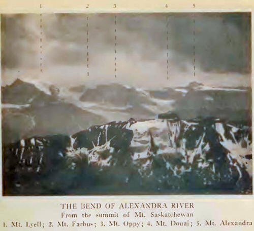
belt. Far away through Terrace Valley rose the white, north face of
Forbes and the glaciated range from Thompson Pass to Lyell and
Alexandra. Snow, mist, and sky; partially hidden in cloud, with sunlight
breaking through: the Columbia Icefield revealed itself. We turned for a
moment to watch the goat; after attempting to dislodge stones on us in
the couloir, they had crossed
some higher ledges
to the north and were soon out of sight. A big billy remained behind on
guard. High on a cliff-ledge was poised an enormous boulder; behind this
he went and was quite hidden. But every once in a while we could see his
bearded face poke out through a crack; he was quite curious about us and
we found him very amusing, the entertainment undoubtedly being mutual.
Through slabby
chimneys, where little showers of icy water came down; up bits of broken
cliff, traversing eastward, we found cracks which led upward. The first
belt, about forty feet high, was surmounted at a point nearly a hundred
yards east of the rock crest between the cirques, and we crossed some
steep bits of snow on the way thither. Under the second line of cliff,
we again traversed eastward before finding a suitable break. On a small
buttress we built a direction cairn to guide our return, and as a
possible service to future climbers. A short distance farther east, we
reached 10,000 feet at a point below and north of the summit. Then
followed long slopes of wet, down-tilted scree and shale, leading to
steep pitches of snow by which the arete was eventually gained. It was
hard work, but the cliffs were well covered, and only once or twice did
small superficial avalanches go down behind us.
In the Italian valleys
of Monte Rosa, there is an ancient legend of a “Lost Valley”; and, just
as the peasants of days gone by may have looked over to the unknown
meadows of Switzerland, so we gazed from the precipitous north face of
our mountain. It was 2.40 P. M., and it became apparent that the point
we had aimed for was not the highest, but that the true summit lay
several hundred yards farther east. To reach it, due care and attention
were given to the cornices overhanging on the north; but with some
step-cutting and a final bit of rock scrambling we reached the top.
North Fork and
Alexandra River meet in a broad sunlit angle; with care, we looked down
the wall to the lighthouse pinnacle, now almost under us. Peaks,
icefields, and glaciers were all about us. We built small cairns,
leaving a record of our North Twin ascent as well—there had been no
visible rock outcrop on its summit—and started down again at just
halfpast three.
On descending, we had
scarcely gotten off the steep snow, when a thunder-shower overtook us.
We crouched in a corner until its violence had passed, and then with
speed were down the rocks and glissading in showers of spray to the
meadows below. We stopped and finished what remained of our provisions,
and strolled homeward over the snow pass. All the western peaks were
aglow with the radiance of sunset; we were refreshed, carefree, and
happy. Without hurrying we arrived in camp at nine o’clock, satisfied
beyond expression that we had been the first to ascend a mountain whose
impressive and imposing architecture had for years excited our
admiration.
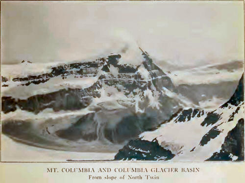
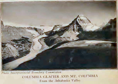
Mount Columbia, the
despotic, white monarch of the icefield, on occasion—with an oft-worn
crown of storm and mist removed—assumes an aspect more benign, although
always serene and majestic. From the north, in the gorge of the
Athabaska, its elevation is best appreciated. It was from the depths of
this valley that the German explorer, Habel, in 1901, saw it and named
it “Gamma.” He was misled by its appearance as a rock-pyramid, and
failed to identify it as the rising, soaring snow-peak which Collie had
described.
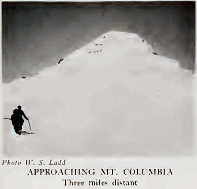
Even from the level of
the icefield, at 10,000 feet, Columbia merits its proud position as the
second elevation of the chain. It had seemed so far above our heads when
we were on Castleguard, we wondered if we should ever reach it. But on
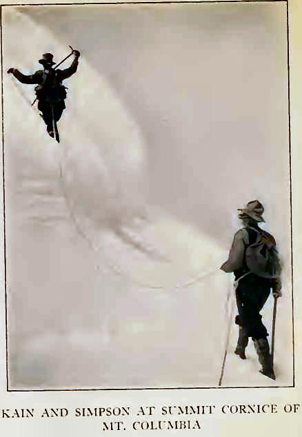
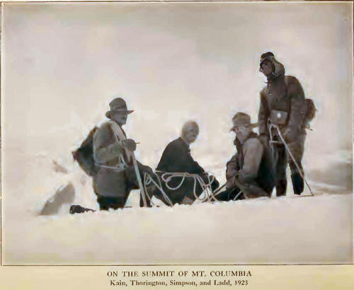
July 14th we started out. The climbing party derived added pleasure from
the presence of Simpson; Jim had been with Sir James Outram and the
guide Christian Kaufmann, but had not climbed, at the time of the
first-ascent, in 1902, just twenty-one years before. Reaching
Castleguard shoulder (3.50-5.30 A. M.), we found the snow in fine
condition and rapidly traversed the tracks made some days previously.
Morning sun was gilding
the ranges; the wind blew forcefully, and we turned toward Columbia,
gleaming in the ice-blue of clear weather distance. Insects innumerable
are carried up onto the ice by air currents from the British Columbia
side; and, at 10,000 feet and above, we collected moths and beetles of
many varieties. One might have some difficulty in obtaining such numbers
at lower elevations; many were still alive, although torpid from cold.
They form the food supply of snow-finches which one sees wheeling and
darting about.
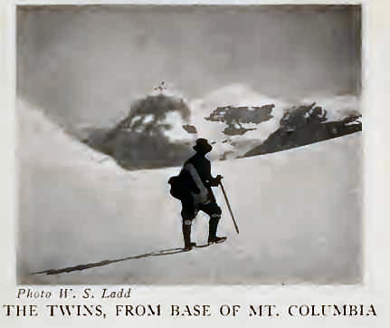
Although favorable
conditions of snow made travel more easy than on our tour de force to
The Twins, we again had to cross many gaps and deceptive, crevassed
hollows. Far out on the icefield, shortly after ten o’clock, we had
lunch on the flat snow above the head of Columbia Glacier. The snow
cirque of the glacier is encroaching on the head of the basin dropping
to Bush Valley; a deep, broken snow pass is formed, which, in years to
come, may isolate Columbia from the icefield. In similar fashion, The
Twins are being cut away from the field through the “plucking” of the
Columbia Glacier basin against the glaciers descending to Habel Creek.
Sun-glare, reflecting
from the high snowfields, may produce severe burns equal to any
resulting at the seashore, and we were glad enough to protect our eyes
with goggles and cover up blistered faces. Thirst is unquenched by the
eating of snow; there is practically no water on the entire icefield,
and, on this climb, we had learned the lesson to carry a small amount
with us.
We were soon at the
bergschrund, a narrow chasm easily crossed, and on steeper snow beyond.
At 11,000 feet we halted by a rocky outcrop where water trickled; we
were in the centre of and more than half way up the great eastern
snow-face, practically treading the Continental Divide. We wondered what
the other outfitters would have said if they could have seen Jim with an
ice-axe, roped in a climbing party? The pitch steepened; steps were
occasionally cut; a stinging, relentless wind tore up the snow-crust
until the air seemed full of whirling white shingles. We toiled upward
for some time in the gale, in some danger of having snow-glasses broken
by bits of flying ice.
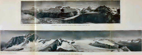
Edward, Mount
Clemenceau loomed in the Wood River area; across the haze of the
Athabaska Valley, beyond South Twin, the mountains toward Yellowhead
lifted in splendour undiminished by distance. In the direction of
Maligne Lake, jagged peaks, of lesser elevation, were dazzling in the
gleam of new snow. Mount Alberta and Mount Bryce, respectively north and
south of us, were things of primitive beauty, distracting attention from
all the rest: Bryce, rising in snowy heights one above the other, with
avalanches falling from its savage northern face; Alberta, cliff-ringed
and austere, its head aloof and wreathed in cloud. Lyell, Forbes,
Freshfield, and a host of others towered gloriously.
The wild gorge of Bush
River can be traced nearly to the Columbia; the Saskatchewan, across the
icefield, flows eastward between Mounts Wilson and Murchison to find
exit to the plains; into the north, one follows the course of the
Athabaska. One retains of it all, chiefly a memory of river
valleys—streams sparkling in the sunlight—winding on their long journeys
to distant oceans.
Forty minutes we spent
on the summit, and fifteen more, out of the wind, on a level spot below
the cornice. The top of Gamma! Let no one think that Columbia is a mere
snow-hump rising from a neve; it is a distinct peak in every sense,
looking its height and quite worthy of its place. Simpson intends to
climb it every twenty-one years from now on!
Softened snow permitted
a rapid though cautious descent, a final long glissade carrying us to
the icefield. Return to the Castleguard shoulder was made in good time,
although we delayed in watching the sunset. The icefield was an empire
of silent purity, brilliant in golden sheen; a rosy haze filtering down
through the Selkirks, lifting them to unearthly heights.
In a little while we
were back at the campfire; just six hours from the summit. We had supper
by the crackling logs, with the cross-lights from fire and western
afterglow. The shadows lengthened, blue-black at the forest edge, and
Conrad told us stories until there was no light remaining save that of
the glowing embers, and the stars that peeped out above our heads.
|
